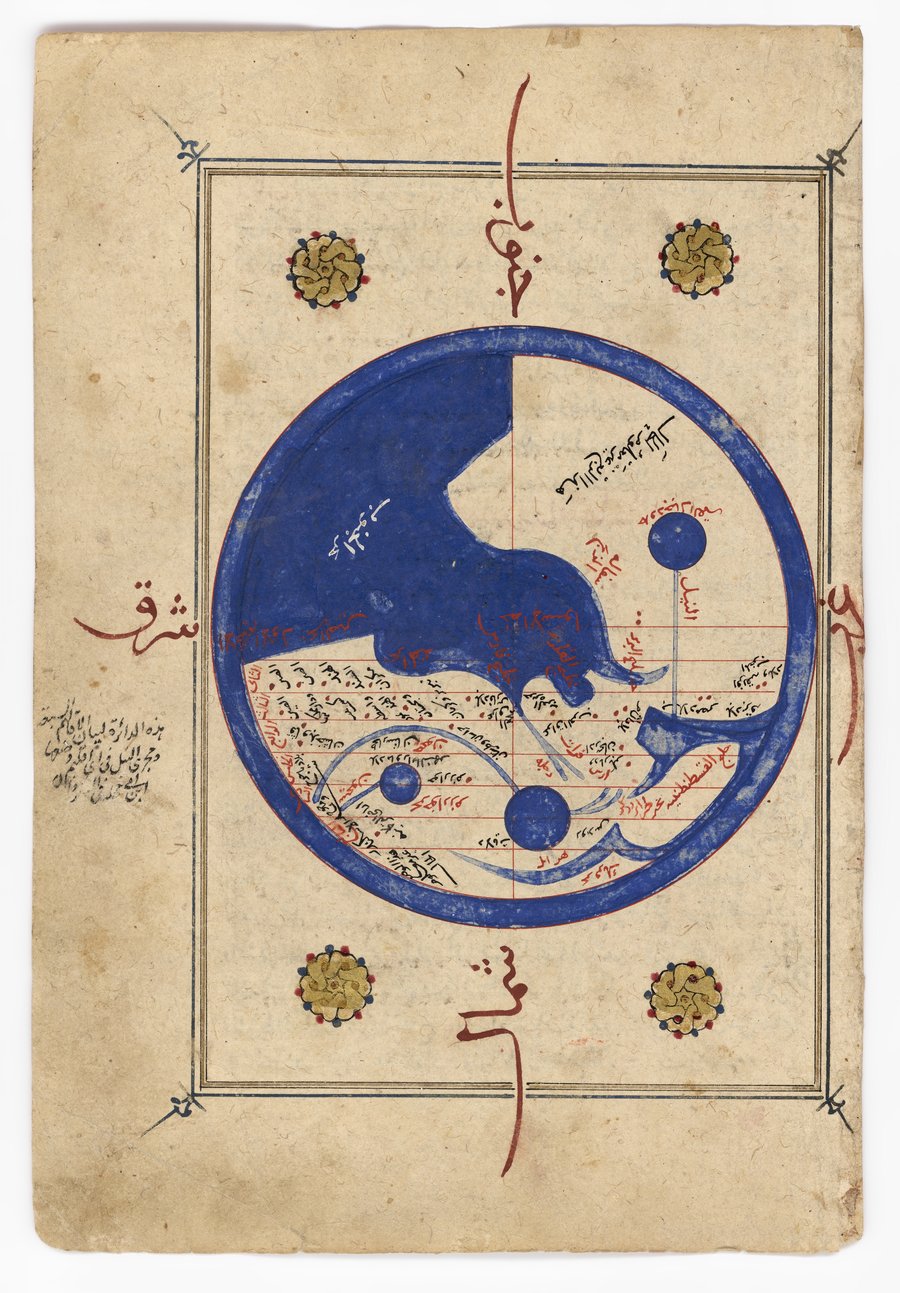
Map of the World
Museum of Islamic Art
- Title:
- Map of the World
- Production place:
- Egypt
- Date:
- 1400 - 1499
- Period:
- Mamluk
- Title:
- Map of the World
- Production place:
- Egypt
- Date:
- 1400 - 1499
- Period:
- Mamluk
- Material:
- Paper, Ink, Gouache, Gold
- Technique:
- Illustration, Calligraphy, Illumination
- Dimensions:
- 27 × 18.2 cm
This map is a hemispherical representation of the world with the south at the top. The world is divided into seven climes drawn with red lines and features the continents of Asia, Africa and Europe, with depictions in blue of the Nile, Tigris and Euphrates rivers and the Caspian, Mediterranean, and Indian Oceans. Set within a border of decorated gold roundels, the verso has twenty-five lines of Arabic text written in black and red, supporting the inclusion of this page within a larger manuscript. This map follows the tradition of cartography developed under the seventh Abbasid caliph Abu al-Abbas Abdallah ibn Harun al-Rashid (known by his regnal name, al-Ma’mun (r. 197-218 AH/813-33 CE) and was directly influenced by the translation of Indian and Greek texts, and Sassanid mathematical geography and cartography.
