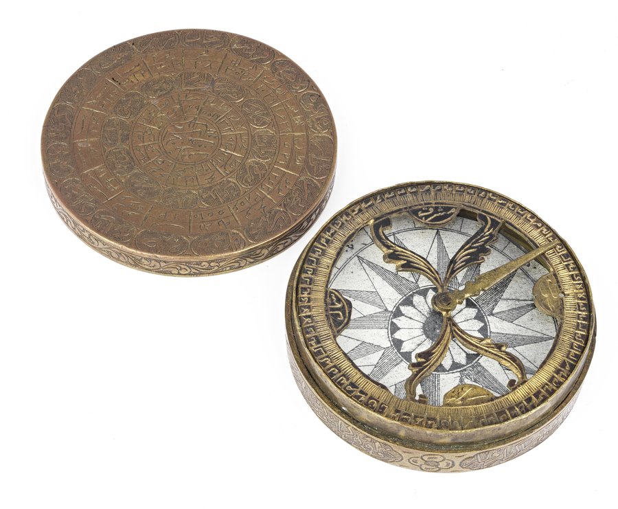
Qibla Indicator
Museum of Islamic Art
- Title:
- Qibla Indicator
- Production place:
- Iran
- Date:
- 1800 - 1899
- Period:
- Qajar
- Title:
- Qibla Indicator
- Production place:
- Iran
- Date:
- 1800 - 1899
- Period:
- Qajar
- Material:
- Brass, Black compound, Paper
- Technique:
- Openwork, Engraving, Casting
- Diameter:
- 6.3 cm
This qibla indicator consists of a magnetic compass with a 360°-division scale inscribed on the front and back with the qibla values, or directions towards Mecca, of some 60 cities, for use in Iran and Central Asia, with a few locations in Iraq and Egypt. The numbers correspond to the localities, the calculated angles or degrees and the directions, which are described with respectively with the words bilad, inhiraf and jiha. Muslims face the qibla when performing their daily prayer, sacrificing animals and when burying someone. Determining the direction of the qibla has always been a major problem, which was eventually left to the jurists (faqih pl. fuqaha), geographers, astronomers and mathematicians. Folk astronomy, geometry and trigonometry were required to calculate accurate geographical coordinates and draw maps, as well as creating tables of qibla values for specific cities, which were eventually reported on sundials, compasses, and astrolabes especially in the Indo-Iranian world. The oldest table was compiled by al-Khazini around 1125 AH / 1712-1713 CE at Merv and copied by many later astronomers.


